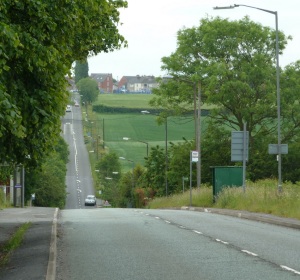
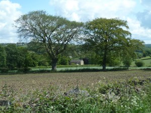
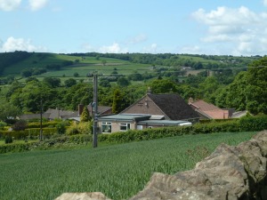
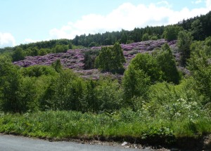
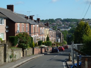
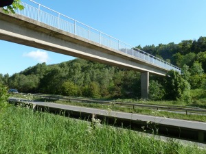
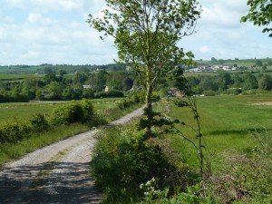
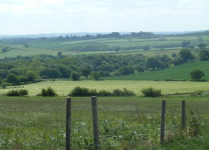
ROADS LESS TRAVELLED

On foot in God's world with faith in God's Word

2011 Rother walks – day 10 – Heath, Sutton Scarsdale, Shuttlewood

leave a comment »

Date – Mon 6 June.  Start – Stockley trail, lane between Palterton and and Sutton Scarsdale.  Distance – 17.5 miles.

This was a double loop shaped route that I in fact started from home in Carr Vale, Bolsover.  Of course the routes could be started anywhere to suit parking or transport requirements.  I have no fixed ideas about clockwise or anti-clockwise for “circular” walks, and tended to make up my mind the day before without too much thought about which way, but trying to take into account some aspects of the route and how it appealed.  This time I wanted to do a long outer loop first to leave a shorter one for the end of the day.

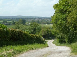
The parking spot at the head is just outside the squares being covered today, which was included in day 1, but there is a shortage of footpaths around Deepdale Farm.  The routes coincided but did not overlap, and I took the first path bearing slightly right towards Heath.  This follows on well from an observation from the previous day, the path being on a direct route between Bolsover church and Heath church.  A footbridge crosses the Doe Lea and then huge open fields belonging to Deepdale Farm.  (RW 10.1 – SK 4568 – Path near Deepdale Farm).

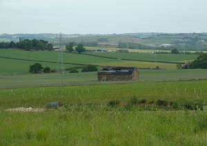
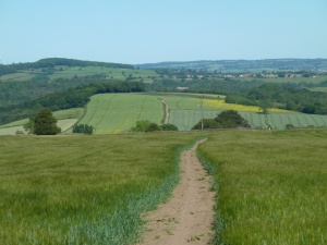
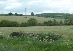
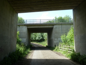
If it was not for the motorway, this would simply be quiet farming countryside.  But the motorway makes its presence felt with the constant noise of traffic carrying a long distance.    The motorway cuts right through the planned walking area, and I was thankful to discover that there are sufficient bridges to enable crossing points for routes to easily visit all the gridsquares without affecting route planning.   The path runs close to the motorway for a short way before heading directly towards the church at Heath.  (RW 10.2 – SK 4567 – Path towards Heath).

The fields here were mainly of oil-seed rape which had been such a vivid yellow a few short weeks before.  The plants are quite vigorous and tend to outgrow any space provided for a path, even if it seemed quite wide originally.  Always be prepared – even if it is not actually raining, you can get soaked up to the chest if it has been wet recently.  This was not a problem encountered today, but even so it was a long stretch through the tall crop.  The subject will crop up again later in this report……  Another major road, the A617 dual carriageway to Chesterfield, was negotiated via bridge, this time over rather than under.  The church was a pleasant spot for a snack break.  The route continued along the old Chesterfield road, glad that it does not still carry all the traffic that now uses the A617.  (RW 10.3 – SK 4467 – Old Mansfield Road, Heath).

The first right turn, Shire Lane towards Sutton Scarsdale, took me back over the modern main road.  (RW 10.4 – SK 4367 – High House Farm from Shire Lane).

At a corner near the next farm on the left, a path leaves past the farm buildings.  Beyond the route was rather unclear, and the exit onto the track to Rock lane is not clear – the 1:25,000 map would have helped with the field patterns displayed.  The walking was straightforward after that, following Rock Lane to Sutton Scarsdale, with occasional distant views through the trees.  (RW 10.5 – SK 4368 – Rock Lane to Sutton Scarsdale).

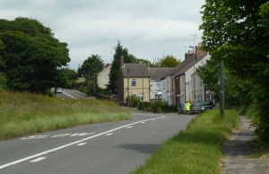
There followed one of the longest stretches of road walking of the entire series.  This was due to a lack of linked up footpaths through both the local countryside and the former industrial areas.  One thing I did notice though, was that the rest of this walk was notable for how much of the route was often in view.  (RW 10.6 – SK 4369 – View from Sutton Lane).

The lane descends through open farmland and then the landscape gradually changes.  There were large opencast workings on Duckmanton Moor in which are now being landscaped, although still at an earlier stage than some other places nearby.  The lane passes under a former railway bridge.  (RW 10.7 – SK 4370 – Former railway bridge, Sutton Lane).

The most noteworthy feature of the area is the full scale removal of a complete village. Arkwright Town used to be south of the A632, but suffered from long term emissions of methane gas from the nearby colliery which closed in1988.  The new village was completed in 1995 and most signs of the original village have disappeared.  (RW 10.8 – SK 4270 – Arkwright Town).

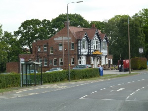
The new village makes an impression when the background story is known of the upheaval of the whole community.  It is by-passed, with no through routes other than the loop off the A619, so easily overlooked.  I walked the loop wondering what it must be like for a complete community to change in such a dramatic fashion.   The main road to Bolosover dips and then rises to skirt the village of Duckmanton.  (RW 10.9 – SK 4371 – Arkwright Arms).

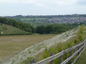
Beyond Duckmanton the road crosses the motorway.  It was only recently that a junction was provided a little further north, which is of great benefit to Boslover and the locality.  It is hoped that a lot of businesses will be attracted to locate at sites being developed on former industrial areas around Markham Lane.   Once across the bridge a footpath provides a view hidden from drivers by high hedges.  It shows a significant embankment overlooking the edge of the new business area.  (RW 10.10 – SK 4471 – Embankment by Chesterfield Road).

The bank, covered with ox-eye daisies in flower, was an unexpected sight.  Beyond the roundabout, the road onwards to Shuttlewood passes through the extensive site of the former Coalite works, a heavy industrial area with much clearance still to be done.  One corner has been opened up as a household waste disposal site.  Even though spacious and grander than any other such site I have seen, it still looks lost in  the scale of the area.  Soon some of the old industrial and office buildings can be seen, and the old railway line past the site is crossed.  It all looks forlorn and rather forbidding, set down in the Doe Lea valley with the river flowing through.   (RW 10.11 – SK 4571 – Part of the former Coalite works site).

The scale of the work still to be done to clear and clean the site is obvious.  The old office buildings near the road are a depressing sight.  Not far beyond are the first outlying houses of Shuttlewood, which must have suffered enormously from the smoke and grime of the industry.  At least the area has a cleaner atmosphere than it did.  (RW 10.12 – SK 4672 – Chesterfield Road towards Shuttlewood).

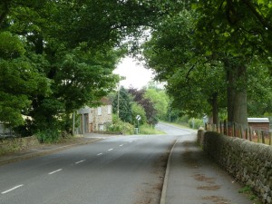
The road continues to climb steadily towards the village.

Written by andrewh00

July 14, 2011 at 2:00 pm

Posted in Uncategorized

2011 Rother walks – day 9 – Chesterfield (west), Old Brampton, Barlow

leave a comment »

Date of walk – Fri 3 June.  Start – Newbold Road / Loundsley Green Road.  Distance – 17.8 miles.

This was a contrasting walk of urban fringe and surrounding countryside starting to rise towards the moors.  It confirmed the rather fine location of the town of Chesterfield, and its rather lop-sided development with large residential districts mainly north and west of the old “centre”.  However, the town limits are more clearly defined in these directions, with real countryside to the west, while to the east and south the many small outlying towns and villages lead to a patchwork effect of built up and more rural scenes.

Newbold is an extensive suburb of Chesterfield, with glimpses of how it was formerly out in the country, for example on Newbold Back Lane where the walk began.  Once on to the modern Loundsley Green Road, it is clear that some the urban planning has worked well, with a sense of green space around.  (RW 9.1 – SK 3672 – Loundsley Green Road).

The road crosses the valley of Holme Brook, which is the continuation of Linacre Brook and the reservoirs to the west (visited later in the day).  I passed through some of the housing estate of Loundsley Green before entering Holmebrook Valley Park, a fine open area with a lake.  (RW 9.2 – SK 3572 – Holmebrook Valley Park).

Now I was heading north toward Upper Newbold, eventually with a short stretch along the B6051 and then the road to Cutthorpe.  (RW 9.3 – SK 3573 – Upper Newbold).

The village of Cutthorpe definitely has a more rural air, set along the road that gradually climbs on the north side of the  Linacre valley.  My route once again turned, this time southwards to recross the valley, in the pursuit of covering grid squares systematically.  There was a good view back to the village houses lining the road.  (RW 9.4 – SK 3473 – Cutthorpe).

The path skirted the grounds and buildings of Cutthorpe Hall, beyond which there is plenty of scope for walkers exploring the valley with a dense network of paths.  I took a direct route across the valley to Woodnook farm and back into the urban fringe of Chesterfield.  (RW 9.5 – SK 3472 – Field and wood near Woodnook Farm).

Once again, modern housing was the order of the day – surely the town will not be allowed to encroach even further into the countryside in this direction?  Linacre Road led to Ashgate Road, where the pedestrian footway petered out at one of the worst spots I have encountered.  The visibility to cross over and continue along Old Road was simply appalling.  It was nice though to see the mature woodland of Ashgate plantation.  (RW 9.6 – SK 3571 – Asgate Road near the edge of Chesterfield).

Old Road briefly combines with the B6150, a busy “quarter of a ring road” around the more extensive northwestern suburbs.  I used a little footpath to cut through to Rhodesia Road and then the main A619 Chatsworth Road.  Despite the imagery of the name, the road is thoroughly urban in character for some distance west from the town centre, and can be a real drag for through traffic with little in the way of alternative routes.  Generally though, the surrounding streets and residential areas seemed more attractive than regular use of the route by car had suggested.  (RW 9.7 – SK 3670 – Brampton Moor Methodist Church).

The busy roundabout near Morrison’s was the place to turn south, along Walton Road.  Moorland View Road certainly lived up to its name as I passed the end of it, rising away from the River Hipper.  The river itself is small and none of the attempts to get decent pictures of it on the walks within Chesterfield were successful.  Eventually I crossed the Matlock Road to reach the gold course.  (RW 9.8 – SK 3669 – Matlock Road near the edge of Chesterfield).

The area of Walton was a mature residential area, no doubt one of the more desirable areas of the town in which to live.  The path by the edge of the course was being redeveloped, at present having open views across the course.  Beyond was the extensive Walton Wood, a pleasant place for having a break in the shade.  (RW 9.9 – SK 3668 – Walton Wood).

After crossing through the wood, a path then followed the edge back towards the Matlock Road above the edge of the town.  A very short stretch of road led to a path by the edge of the grounds Walton Lodges, in view across an expanse of parkland style meadow.  (RW 9.10 – SK 3568 – Path by the grounds of Walton Lodge).

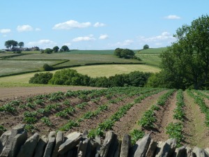
The path then crossed open fields, neatly striped after recent cutting for hay.  Once again I was approaching the fringes of Chesterfield.  (RW 9.11 – SK 3569 – Path to Walton Back Lane).

Finally I was on a proper leg of the walk, due to continue steadily northwest then northeast rather than chopping and changing direction.  Next i was recrossing the river Hipper and the A619 closer to the western edge of town.  The picture shows that bits of new building are still taking place, this looking like a bit of infill.  (RW 9.12 – SK 3570 – New houses on Chatsworth Road).

Another development was that the route was about to become truly rural for a sustained distance, which was good.  After crossing fields, Piper Lane already fitted the bill for a rural setting, being a farm track rather than a road.  (RW 9.13 – SK 3471 – Piper Lane towards Broomhall Farm).

From the farm Nuttack Lane up to Old Brampton was barely even a track rather than a footpath.  It all seemed much further away from the bustle of Chesterfield and the busy A619 than it really is.  The little valley gave an intimate atmosphere.  The steady climb to Old Brampton brought wider views of the slopes rising towards the moors from Chesterfield.  The village itself straggles along the lane, centred on a very attractive church.  (RW 9.14 – SK 3371 – Church of St Peter and St Paul, Old Brampton).

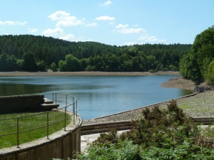
The village is close to the ridge line between minor valleys, so it was across and down to the one distinguished by having three reservoirs in lovely wooded surroundings.  They were constructed in the late 1800s to supply water to Chesterfield, and would be more than just a local attraction if it were not for the Peak District National Park being close by.  With the dry spring, they were all suffering from low water levels.  (RW 9.15 – SK 3372 – Linacre middle reservoir).

Once again the sight of the signs of water shortage turned my thoughts to the many places where the situation regarding water is far more difficult.  And what beauty water brings to a scene!  I have never been drawn to desert landscapes, although I appreciate many people find them the most wonderful places.  I am very content with a temperate climate and a decent amount of rain, although eastern England is hardly wet by world standards.  London has a lower annual rainfall than many unlikely places, it is just that it tends to be little and often, and distributed throughout the year.  The narrow head of the upper reservoir was dried out with cracked mud in view from the path above.  (RW 9.16 – SK 3272 – Linacre upper reservoir, dried up).

Thankfully the woodland and fields around still looked quite fresh and green, but there are concerns about the way that the summer might progress.  The dry weather has been accompanied by drying breezes, but not with great heat which must have been a help.  From the end of the woodland, an uphill path climbs to the next ridge north near Pratthall, where the B6050 is on its long, gradual descent from the moors towards Cutthorpe – two names with “tth”….  (RW 9.17 – SK 3273 – B6050 near Pratthall)

The road twists and turns in this section between little hamlets.  Ingmanthorpe was not far down, where the next footpath left past Thorpe house.  Beyond the farm the path continues down a minor ridge with very fast and easy walking across arable fields.  (RW 9.18 – SK 3373 – Farmland below Ingmanthorpe).

Once again another little valley had woodland by the stream.  Nearly all stream crossings are provided with footbridges, which come in a great variety.  They all require upkeep, and I do appreciate the ongoing work and expense that must be required to keep up a good network of footpaths.  Whilst some routes are busy and suffer a little from overuse, many others are underused and I fear the danger of losing precious access to countryside if rights of way are decommissioned.  Encouraging responsible walkers to make good and careful use of footpaths must be encouraged as much as possible.  I have always found it great fun to study maps and work out my own routes rather than relying on guides, and it would be good to see more signs of others doing the same.  The ups and downs continued with the hamlet of Newgate just below the skyline of the next ridge north.  It was only a short climb, and the ridge path to Barlow was soon being enjoyed.  (RW 9.19 – SK 3374 – Path from Bole Hill to Barlow).

The path to Barlow was another delight of the walk with grand views.  The path heads for the church, as so many old established  routes that are now footpaths.  Here the little church is at the heart of the village, although this is by now means always the case.  The start of the next footpath was very difficult to find even when looking out for it carefully.  There is a sign, but I doubt any casual passer by would notice it.  This path was important as the only alternative to road walking in the next square east, and I was glad to find it after having past it and retraced my steps.  The walk was through delightful lowland fields with a mix of meadows and arable.  (RW 9.20 – SK 3474 – Meadows near Barlow).

The correct route for the path was a little uncertain, but the field edges had ample margins, but towards Dunston Hole Farm it became well marked out on the ground.  This square was surprisingly quiet and rural being so close to Chesterfield on one side and a large industrial and business park not far away on the other.  The walk was very pleasant, with a buttercup meadow in full flower on the approach to the farm.  (RW 9.21 – SK 3574 – Meadow by Dunston Hole Farm).

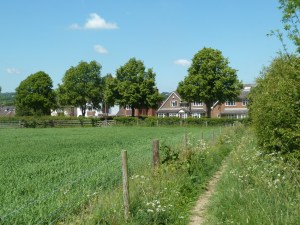
Sadly, the use of the path necessitates walking along the B6050 (Dunston Road) to continue the walk.  (The picture below shows how the industrial park is hidden away in a dip beyond the second field and first line of trees – there are few places where it imposes on the view).  Time and again this question arises with our right of way network.  This roadside is hardly suited to walkers with narrow verges and awkward  bends.  After passing Dunston Hall I cut across to Dunston Lane heading back to the edge of Chesterfield.   (RW 9.22 – SK 3674 – View north from Dunston Road).

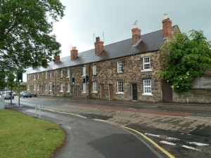
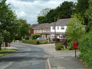
Soon back in suburbia, I noted a whole area with street names devoted to favourite places in the Lake District, with fond memories of living in Cumbria and north Lancashire in times past.  The final picture was taken of houses on Dunston Lane opposite the primary school, close to the end of a fine day’s walk.

Written by andrewh00

July 13, 2011 at 1:58 pm

2011 Rother Walks – day 8 – Duckmanton, Stanfree, Staveley

leave a comment »

Date of walk – Thu 2 June.  Start – Duckmanton village.  Distance – 17.1 miles.

Duckmanton, from some places to the west, looks like a fairly typical countryside village, up on a low hill.  It is however far from typical in the amount of industrial activity, past and present, in the vicinity.  There are former coal mining areas on almost every side, and an open cast mining area to the north has added more recent marks to the landscape.  However, being within the area for the walks, it was now time for one of the more unusual walks on the agenda.  I was unsure when setting out whether one of the squares was going to remain unvisited due to poor access options.

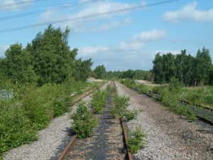
Almost immediately a diversion was necessary.  The path shown heading directly north to Poolsbrook through the open cast mining land was diverted to the west, the path only discovered after wandering around a rather forlorn looking children’s recreation ground.  The path took me into the edges of two squares planned for later in the day before curving east and entering Poolsbrook, as expected, from the south.  Poolsbrook is a quiet place with any through traffic skirting the edge of the village.  Despite warning signs, the railway crossings beyond are very quiet these days, with the last train having departed long since.  As the pictures show, it was another fine day.   (RW 8.1 – SK 4473 – Former railway line, near Poolsbrook).

The line served a large coal depot taking coal away from several of the nearby pits.  The scale of the site is still evident on the ground.  Small corners are beginning to emerge as natural habitats with a mix of wetland, woodland and meadow, but still large tracts of hard core waste land.  The maps venture to show a path across the area of the railway yard, but, as expected, all was not too clear on the ground.  However, there were few signs of access being restricted and a way could be found keeping close to the right route.  It felt a strangely remote, out of the way sort of place.  One flat, low-lying area had the most prolific display of red campion I have ever seen, sadly not showing up too well in the pictures taken on the day.  By now I was close to the motorway, and approaching what turned out to be one of the surprise views of the trip.  This was the River Doe Lea motorway bridge…..  (RW 8.2 – SK 4573 – River Doe Lea motorway bridge).

I soon realised I needed to cross on the other side of the river, and this would provide access to the uncertain square.  This was duly accomplished, even though there was the feeling that not many people pass this way at present.  Perhaps further clearance of the land and redevelopment will open it up once again quite soon in the future.  Heavy vehicles are often operating in the area to the south.  I ventured near the bank of the river, but could see no sign of the path continuing across the square, and glad I had not planned a through route.  The path on this side of the motorway also was not in evidence on the ground, so I went back under the bridge and followed a wide concrete track to the next bridge, this time a footbridge / farm track bridge over the M1.  A clear track looped around to Woodside Farm and then to Woodthorpe Road, through typical arable farmland for the first time on this route.  Bentinck Road is a long double terrace set apart from the village of Shuttlewood.  A planting scheme along the road, a project from 2004, makes it rather distinctive.  (RW 8.3 – SK 4673 – Bentinck Road, Shuttlewood).

From the far end of the street, there was a view to the right across fields to the main village, but I continued straight ahead to the Clowne road, following it for a short distance to the scattered village of Stanfree.  (RW 8.4 – SK 4773 – Clowne Road from Stanfree to Shuttlewood).

The road dips and rises, and there is countryside around without being especially attractive.  Rising on the side lane to Oxcroft,  the hillside ahead is more appealing and wider views open out behind to the west.  (RW 8.5 – SK 4873 – Above the road to Stanfree from Oxcroft).

A path rises through a strip of hillside woodland to cut a corner, and another path leaves immediately towards Clowne.  This is the continuation of the slopes overlooking the Doe Lea all the way from Hardwick Hall via Glapwell, Palterton and Bolsover, although less steep towards the north.  The path is set back a little with occasional rather than continuous views out to the west.   Nearer to Clowne the hillside is gentler still, but more open with wide views – a good place for a snack stop.  I turned sharp left to follow a clear path diagonally down to the northern side of Stanfree village – the picture was taken looking back up the fields.  (RW 8.6 – SK 4874 – Path to Clowne from Stanfree).

Appletree Road led back to Clowne Road, almost directly across to Bridle Road,  then a path linking with Romeley Lane.  (RW 8.7 – SK 4774 – Farm track to Romeley Hall Farm).

The next path was one of the most difficult to follow on the ground.  I was glad of the assistance of the pleasant lady owner who directed me across the start of the route past various farm sheds.  The path was important in linking squares with few alternatives for through routes for walkers.  Beyond Romeley Hall Farm the path was unclear all the way to the stream before the motorway – going the other way it may have been easier to pick out the correct route.  I tried to avoid disturbing crops as much as possible, but field edges led me astray north towards Romeley Wood.  However, I persevered and eventually regained the clear track for the last stretch to the motorway bridge.  (RW 8.8 – SK 4674 – Small valley below Romeley Wood).

West of the motorway the path was much clearer, apart from potential confusion crossing the line of an old railway.  The walking was now easy and the village of Woodthorpe directly ahead across open wheat fields.  (RW 8.9 – SK 4574 – Towards Woodthorpe from the east).

The miniature steeple belonged to the school, set in lovely grounds with a flower lined footpath by the edge.  The attractive little church nearby is presently unused for services.  The village is very close to to the A619 with motorway access, yet little through traffic, and seemed a very quiet little backwater.  I continued west and along Bridle Road and then a  path to Staveley.  The most distinctive feature was the main building of Netherfield School, but a failed to get a picture.  The view of Bridle Lane was not really typical of the route, which generally had a much more open aspect.  (RW 8.10 – SK 4474 – Bridle Road near Woodthorpe).

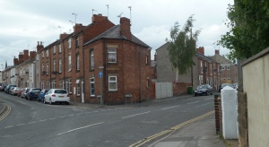
The edge of Staveley was previously industrial, once again with an area undergoing a slow transformation into a country park with woodland and pools in the gentle valley floor of the Doe Lea.  A path skirts between houses and a small industrial park to cross an imposing footbridge over the old railway, and then I headed over the new road towards the town centre.  As always, there is more to any place than the impressions gained from the main route or road through.  The High Street south of the church is quite attractive and free of traffic.  There is also a row of particularly distinctive terraced houses.  (RW 8.11 – SK 4374 – Porter Street, Staveley).

Back on the main road, there was time to take a proper look at the modern Methodist church, built to replace the former building sacrificed to a road widening scheme.  From one limited angle it actually looks quite attractive and interesting, otherwise unappealing, at least to me.   For a while it ws simply a case of continuing along or close to the A619 Chesterfield Road.  (RW 8.12 – SK 4274 – Chesterfield Road, Staveley).

The older housing gradually gives way to more modern development, with a couple of local shops.  (RW 8.13 – SK 4273 – Shops by the A619).

The road then descends into a leafy little valley with a brief interruption to the built up character.  At the bottom is an awkward road junction with Inkersall Green Road and Troughbrook Road.  This is at the corner of Ringwood Park, which despite its somewhat uninviting car park opens out as an attractive area with a lake as the highlight.  (Rw 8.14 – SK 4173 – Lake, Ringwood Park).

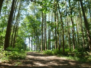
The south was covered in water lilies, just about to break into flower.  Beyond the park is a little gem of valley woodland, quite a surprise with built up areas so close at hand in all directions.  Trough Brook, a small north flowing tributary of the Rother, has certainly a clear cut little valley of its own, and the wood is West Wood.  Woodland, and especially woodland streams, always seem difficult to capture on camera, and the subtle differences of massed trees when on the ground are lost to a large extent.  However, a woodland picture is selected for this square.  The valley path is not long, but quite steep in places, with very slippery mud underfoot in wet winter conditions.  This time it was dry and easy going.  (RW 8.15 – SK 4172 – West Wood).

A modern housing estate abuts right on to the top of the woodland, so I was soon following the street around the southern edge of Inkersall towards the track along another of the old railway lines that are such a feature of the area.  This one headed back towards Staveley.  They provide easy walking, but not always enabling the area to be seen to its best advantage, as was largely the case here, with generally rather restricted views.  The wide, well surfaced track is good for cycling and for heavy use, but makes for dull walking.  (RW 8.16 – SK 4272 – Glimpse of Inkersall from old railway).

There was a second bite of SK 4273 before heading towards Poolsbrook Country Park.  The park is obviously popular, with a busy caravan site.  The landscape is also still at  quite an early stage of development, and looks a bit stark in some ways – no doubt it will continue to mature.  Hopefully the pylons will lose something of their dominance of the scene.  There will be more to be said about the large Rother Valley Country Park near Killamarsh, a feature of the penultimate walk.  The picture hopefully gives a fair representation from the caravan site service road.  (RW 8.17 – SK 4373 – Poolsbrook Country Park).

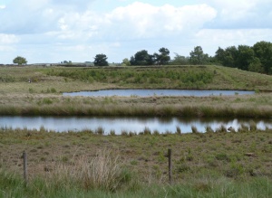
At the south end of the lake I found the little path I wanted continuing up the little valley. Almost immediately you are transported into a fresh area of the park which I would suggest is already a stunning success.  It must have been the most prolific flower meadow I have ever seen, with a small, more natural looking lake in the centre, framed by trees set back at just the right distance – altogether a breathtaking sight.  The picture shows the dominance of the yellows, but there was a real mix, including a good number of orchids.  (RW 8.18 – SK 4372 – Meadow and lake by Pools Brook).

The picture was taken from a worthwhile short diversion – the path I wanted leaves back by the lake up through the trees on the left (on the right in the picture).  This linked up with a larger track to Duckmanton.  (RW 8.19 – SK 4372 – Track to Duckmanton).

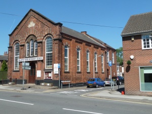
The views to the west are quite extensive, but I was soon back in the village, noting the smart little Methodist chapel to select as the picture for the final square.  (RW 8.20 – SK 4472 – Duckmanton Methodist chapel).

2011 Rother walks – day 7 – Holmesfield, Owler Bar

leave a comment »

Date of walk – Tue 31 May.  Start – Car park, Shillito Wood, Fox Lane.  Distance – 17.2 miles.

This was one of two roughly figure of 8 style routes included in the itinerary.  It seemed to be the best way I could work out from the map to create routes visiting all the squares.  Another feature of this route is the highest ground within the Rother basin.  It was one of three walks to include moorland on the fringes of the Peak District, on the skyline I can see in the distance from home in Bolsover.  In my mind they were anticipated as highlights, having more familiar attributes for the type of countryside walking people in the area would expect to visit for a proper day’s walk.  The car park is well sited for walkers, with a helpful information board.  I was able to head directly across the lane into the shallow valley head, turning north.  The valley quickly becomes deeper and quite steep sided below Fox Lane.  (RW 7.1 – SK 2975 – Valley path below Fox Lane).

A brief shower passed, with no further rain all day.  This was real walking country as far as I was concerned, but the schedule did not allow time to slow down and properly savour the surroundings.  It must be emphasised that photos just had to be quickly snapped as I passed by, to provide a visual record of moments unfolding along the route.  They reflect the conditions of the time, and are not always what a dedicated photographer would be aiming for.  I turned right along Car Road, a farm track.  (RW 7.2 – SK 2976 – Car Road, and barns by Smeekley Wood).

The track becomes more of a lane as it approaches Fox Lane.  I continued east, downhill (a change for the start of a day) to the first path marked on the maps heading south.  It starts by going through the front and side garden of a cottage.  It is interesting and sometimes quite strange to consider the routes taken by rights of way, and the great tracts of land officially off limits due to lack of rights of way.  This was a case where I felt as though I was trespassing although on a right of way.  A steep down and up across a valley led to Unthank Lane.  Unthank is a name that occurs occasionally in the north of England, with examples in Cumbria and Northumberland.  A scattered hamlet straggles along the lane, including Unthank Hall, amongst attractive countryside.  (RW 7.3 – SK 3076 – Fields and trees by Unthank Lane).

The lane twists and turns, and at one corner I continued eastwards along a path to Millthorpe.  It was easy, gentle walking to and through the attractive village.  The walking route meant that I saw the ford down a little side lane, a reminder that this project was taking me through many hidden little corners of the area, whether rural or urban.  “No through road” signs are welcome when hunting for less visited places to explore.  From Millthorpe it was uphill on the lane up to Holmesfield out of the vailleg, with good views back.  (RW 7.4 – SK 3176 – Overlooking Millthorpe).

The next path, avoiding the lane up the hill to Cartledge, went along driveways and across gardens in a similar manner to the one mentioned above.  The square was also visited on a later walk to see more than just the top corner crossed on this route.  There were several horses in one of the hillside fields.  The route again proved its worth by including the dead end lane serving the most interesting part of the hamlet of Cartledge, with lovely old houses and clusters of farm buildings.  Back on Millthorpe Lane the climb continued up to the hilltop or ridge top village of Holmesfield, the second, last and largest village of the day.  (RW 7.5 – SK 3277 – Village scene, Holmesfield).

The church has a fine setting on the ridge, and the notice board proclaimed a clear message – “Jesus died and rose again from the dead for you – follow Him”.  It was nice to see the Gospel proclaimed as it should be, made relevant and personal to everyone.  The main road continues west keeping close to the watershed – to the north was the forbidden territory of headwaters of the River Sheaf above Sheffield.  Looking back the church was still in view.  (RW 7.6 – SK 3177 – Fields west of Holmesfield).

The road continued to rise gently to the hamlet of Lydgate, where the view ahead to the moors suddenly opens out win a great sweep.  For me this was one of the visual highlights of the whole series of walks, so no doubt about the picture choice to follow.  (RW 7.7 – SK 3077 – Road to the moors from Lydgate).

This leads me to reflect on the fact the photography so often fails to do justice to the reality.  The picture is bound to mean more to me or someone else who already knows and enjoys the place.  I remember seeing the Apls for the first time, and however familiar the mountains were from the many pictures I had pored over in books and brochures (days before the internet…..) nothing could prepare me for the impact of the scale of the scenery when on location in real life and experience.  A photo reduces a scene to something so small and one dimensional, and yet I still love looking at pictures of places from all around the world.  I am sure the picture should at least convey something to anyone who appreciates landscape.

SIDELINE – This line of thought is so true when it comes to Christianity as well.  No description or looking in from outside can begin to appreciate what it is like to know the Lord Jesus as personal Saviour, for real.  At best the concept is one dimensional and dull.  But when the life, death and resurrection of Christ is applied personally, as Paul did when he wrote about “the Son of God who loved me, and gave Himself for me”, then the dimensions of a living, personal relationship are entered.  “The Lord is my Shepherd”, David wrote.  Knowing Christ as Saviour opens up new dimensions of forgiveness, holiness, joy, peace, love, hope, heaven, eternity, the very definitions being elevated to entirely new levels beyond the experience of any life that is lived apart from Him.

From the viewpoint in the picture a path heads south which I followed (the more westerly one of the two shown on the map – I was glad I double checked after nearly starting along the wrong one).  A lovely open meadow was an ideal place for a break in the sun for a snack and some vital drink.  Beyond the hillside steepened with a considerable descent to the valley.  It was the a question of following the B6051 on its gradual climb up the valley to Owler Bar.  The route cannot be recommended for walkers despite the attractiveness of the scenery.  I swapped from side to side, trying to asses all the time which was the safest.  On some corners it was obvious that that the rule that walkers should face oncoming traffic needs over-ruling on some occasions.  Across the valley there was a sight that made up for the awkward nature of the walk.  (RW 7.8 – SK 2977 – Rhododendrons below Owler Bar).

However, despite the spectacular display, which only lasts a short while, rhododendron ponticum becomes very invasive and can take over large tracts of countryside.   There is a transformation from an enclosed valley to the open moor as the road rises to the west.  At the top there is the extraordinary road junction at Owler Bar – a greatly elongated roundabout with three exits at one end and two the other.  Overlooking is the Peacock Inn.  The B6045 heading towards Hathersage was the exit for the continuation of the walk.  The little stream crossed is insignificant, but drains the highest ground within the Rother basin, so I had to nip over to go into the map square and grab a picture, despite the light being less than ideal.  Whether the Rother can lay any claim to the summit above Flask Edge I couldn’t say, maybe it gets squeezed out on the upper slopes.  (RW 7.9 – SK 2878 – Highest ground in the Rother catchment area).

After the brief detour I continued along the road as far as the enclosed gas national grid installation.  There were gateways onto access land here on both sides of the road, so I followed a faint track across the moor which joins the one marked on the map.  It was great to be out on the wide open moor with the sense of space.  It may lack distinctive features, and I do love more intimate and varied terrain, but there is a strong feeling that being up there simply does you good.  (RW 7.10 – SK 2877 – Open moorland vista).

The gentle valley in view feeds south to the Derwent river system, so the Rother only just fringes on the high moorland.  For the sake of the project I had to veer towards the main road.  Since I was unsure about access on and off the access land I kept to the track and walked along the road.  It had wide verges but not much evidence of regular foot traffic at Car Top.  The road felt like an intrusion into the moorland landscape.  (RW 7.11 – SK 2876 – By the road across Car Top).

There were extensive areas of woodland with small trees doing well to survive and grow in the poor moorland soils and the exposed windswept location.  Heading south Car Top merges into Ramsley Moor, where an inviting track leaves the road.  (RW 7.12 – SK 2875 – Green path across Ramsley Moor).

The track was also inviting to the local herd of cattle, with more grass on it than on the surrounding heather moorland.  They barely lifted their heads from grazing as I passed in front of their noses – there must be just enough walkers for them to be used to people without the track getting worn.  The short grass was lovely underfoot and the walking was the just about the easiest and pleasantest of the series.  I had a quick look at the ruins of Ramsley Lodge in its exposed position, and continued around the corner of the woodland towards Ramsley Reservoir – or at least what was Ramsley Reservoir.  The newer editions of the OS maps show the recent reduction to a series of small pools.  A perverse consequence was that the footpath around the north and east side is closed and diverted because of waterlogged ground.  So the view of the remains of the lake was from the west.  (RW 7.13 – SK 3874 – The remaining waters of Ramsley Reservoir).

The dam can be seen on the far side, with the breach that has been created to the right – another section of the dam continues right of picture.  It’s difficult to picture what the reservoir looked like when full, having never visited the site before.  A heron flew off as I approached – I wonder what the overall impact on flora and fauna has been of the creation and then destruction of the reservoir?  The far top of the dam was a suitable place to ponder the question for a while during a snack stop.  The route then crossed the next square east passing close to the car – the picture will come at the end on the homeward return.  Leash Fen stretched out to the  right of the lane.  I turned left along Unthank Lane towards the edge of the plateau.  As it descended into woodland at the head of a valley, I looked out for the footpath across Meek Fields towards Moorhall.  The path was not always easy to follow – the secret is to look out carefully for the little stone stile gaps in the walls.  (RW 7.13 – SK 3075 – Meek Fields).

The open fields provided a pleasant walk towards the hamlet of Moorhall.  The next path soon left the lane to cross the valley through Grange Wood to Barlow Grange.  There was no mistaking the footpath above Grangewood Farm.  (RW 7.14 – SK 3174 – Footpath above Grangewood Farm).

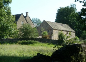
The afternoon light provided and the hillside beyond Grange Wood provided a series of fine views across rolling countryside.  A few farms and cottages are scattered around, taking full advantage of the surroundings.  (RW 7.15 – SK 3274 – Cruck Barn on Grange Lane).

Cruck Barn had been attractively renovated and extended.  The path I wanted headed downhill immediately opposite, overlooking Crowhole Reservoir.  Once again the floor of the valley was characterised by woodland.  It was then uphill once more to Far Lane which runs along a low ridge.  A path cuts northeast towards Bradley Lane, the B6051, near the lowest point of the day.  (RW 7.16 – SK 3275 – A valley meadow by Bradley Lane).

The road was crossed, with a pleasant footpath across the stream to the intriguingly named Highlightley Lane.  The farm sharing the name, by the lane, had a range of buildings sadly falling into disrepair and ruin.  I headed along the lane back to a minor crossroads on the B6051.  (RW 7.17 – SK 3276 – Highlightley Lane).

The dead end lane beyond is Johnnygate Lane towards an old manor house at Barlow Woodseats.  From this point the route climbs steadily back towards the moorland.  The manor house has historic associations including links with Bess of Hardwick.  (RW 7.18 – SK 3175 – Barlow Woodseats).

The house was for sale when I passed by – an interesting proposition for people with the time and money to invest, and a desire for a peaceful location. The next section was rather enclosed in woodland with few open views before reaching Moorhall.  Nevertheless the gradual climb was still attractive.  By this stage I was glad that I had left the direct route until the way home to complete the loop.  It was simply a question of strolling along the lane by the edge of Leash Fen.  (RW 7.19 – SK 3074 – Fence across Leash Fen).

The fen largely seems to really belong to the Derwent system, but the map also suggests a link into the Rother, via artificial drainage channels that are mapped as being joined up.  My route joined up as I retraced steps along the lane towards the car.  (RW 7.20 – SK 2974 – Lane by Leash Fen).

And so the varied and enjoyable walk cam to a close.  It was most satisfying to see the plans being activated and achieved.  There was enough of a challenge involved without the whole prospect becoming overpowering.  Gradually each part of the area was being visited on foot in a systematic way, revealing many interesting and attractive spots that could easily be overlooked by locals and visitors alike.

Written by andrewh00

June 29, 2011 at 10:36 am

2011 Rother walks – day 6 – Eckington, north Staveley, Ridgeway

leave a comment »

Date of walk – Mon 30 May.  Start – Eckington church.  Distance – 16.8 miles.

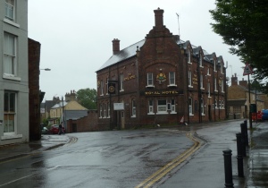
Circumstances led to a later start than usual, but the bonus of having the use of the car for the trip.  It was a wet morning, and ended up being the only day I set off in rain.  I need hardly add that it was a bank holiday Monday.  Eckington town centre had a rather deserted air with some of the shops and businesses closed for the day.  (RW 6.1 – SK 4379 – Royal Hotel, Eckington).

From the hotel, I followed Southgate south, which soon led to the B6053 Staveley Lane.  With Renishaw park on the left, the road is quite rural, and also provided with a pavement for a considerable distance, so it proved to be a better route than I had anticipated.  (RW 6.2 – SK 4378 – B6053 Staveley Lane).

One advantage was that there was no need to fiddle around too much with maps and route checking.    Progress was straightforward and there was enough of change of scene and interest to keep me going quite happily.  The road took me right through the next couple of squares too, partly because of a lack of alternative through footpath routes.  (RW 6.3 – SK 4377 – Continuing along Staveley Lane).

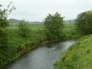
It may look gloomy, but I find a grey day quite atmospheric, and to me the pictures pick up something of that as well. Yes, sometimes the clouds close right in and make visibility so poor that photography is pointless and the surrounding terrain is wiped out from view, but that is by no means always the case on a wet day.  The road eventually crosses the River Rother, with the inevitable railway line crossing at almost the same spot.  (RW 6.4 – SK 4376 – River Rother from Staveley Lane).

The road continues on, but with a change of name, rising up Hawthorn Hill.  This section is without a footpath so requires more care for walkers.  Approaching built up areas, the path is reinstated.  Apart from a few farms, the first place is Hartington, virtually a suburb of Staveley.  (RW 6.5 – SK 4375 – Hartington, near Staveley).

Beyond, I carefully selected the footpath route rather than crossing the bridge over the new road, only to find that a whole section was closed.  There were lots of paths, and some signs, but it was very confusing finding the right way to proceed.   There was no link for walkers on to the new road, so I ended up looping into Staveley, straying into a square reserved for a later walk.  However, the rain was easing almost to a stop, although the real clearance was much later.  Descending from Sraveley to the new roundabout, the reason for the footpath closure was spread before me – large scale works on the local section of the Chesterfield canal, which has been disused for years.  The canal is to be redeveloped, with the prospect of a marina as well, which could be a real boost for the locality.  Beyond, the edge of an extensive old industrial area of the Rother valley is entered along Hall Lane.  (RW 6.6 – SK 4275 – Road and railway near Staveley).

Hall Lane is another road far from suited to walkers.  In the picture, a small section of new footpath can be seen alongside off to the left among young trees.  This soon ends at a narrow railway bridge, and then the walker has to make use of whatever verge is available.  The lane climbs gradually but persistently, passing some distance from the edge of Barrow Hill.  The open fields now have the sense of being undisturbed by past industrial activity, at least in recent history.  The lane changes name to Staveley Lane and in the next square the transformation from urban to rural is complete.  A single cluster of farm buildings and a nearby cottage are the only ones in the square.  (RW 6.7 – SK4176 – Farmland above Barrow Hill).

The twin chimneys of the Barrow Hill brick works are a local landmark.  A path descending east to White Lodge means they soon disappear from view.  The next square north has very little access by road or footpath, so the next picture features the corner of a field where the path nudges briefly into the required area.  (RW 6.8 – SK 4177 – Field corner below Staveley Lane).

The path continues to meet Breck Lane where it turns into a track at White Lodge.  The picture overlooks the farm.  (RW 6.9 – SK 4276 – Overlooking White Lodge).

The next square required was north, so only a corner of the White Lodge square was visited.  The path headed away from open fields towards Foxstone Wood.  There is no road access into the square, just private farm tracks and access to a fishing lake in the woods.  As can be seen the rain still had not completely given up.  (RW 6.10 – SK 4277 – Fishing lake in Foxstone Woods).

The track through the woods was an attractive part of the route, and the edge nicely coincided with the  change of square.  The path continued across fields, rising slightly towards the edge of Eckington.  The route looked as though it was once well established with a walled lane, but now even the footpath seems little used.  (RW 6.11 – SK 4278 – Fields between Eckington and Foxstone Wood).

Eckington is another place that has much more to it than the impression of driving the main through route provides.  Each place in the area develops its own character as you begin to become more familiar with them.  So many places are just thought of as a drag to drive through en route to somewhere of interest and therefore dismissed.  Walking around the area is opening it up in a way that I am finding worthwhile and of absorbing interest, even at the stage of just scratching the surface.   (RW 6.12 – SK 4279 – High Street, Eckington).

I followed a track round the northern side of a  modern estate which backs onto a fields with woodland beyond.  It was encouragingly free of litter and rubbish.  As I continued, rain set in once more, although not as long or as heavy as in the morning.  A path skirted the school grounds and route finding became uncertain.  The clear path in the picture is not shown on maps, but the route marked is barely discernible on the  ground.  (6.13 – SK 4179 – Path to High Bramley Wood).

Once again, it was an area lacking in route signs that seemed to be one where the farmer does not like straying walkers.  I take great care to follow routes as exactly as possible, but without a 1:50,000 map with the field boundary markings, it was not always easy.  It only takes markers at a few strategic points to help – in most places I had no difficulties without the more detailed mapping.  Anyway, I arrived at the right point on Ford Lane, followed it briefly before risking another footpath.  This was mainly clear apart from the start of the way to go round rather than through Bramleyhill Farm.  (RW 6.14 – SK 4079 – Track to Bramleyhill Farm).

The farm is set on quite a steep hillside above the valley of The Moss, a tributary of the Rother which forms a deep valley and an important country corridor south of Sheffield.  It is one of the few areas where I heard the cuckoo calling on these walks.  The walk across the valley was delightful, as the rain really did begin to clear away properly.  The near and further views were attractive and varied.  (RW 6.15 – SK 4080 – The Moss valley).

The route climbed and then skirted across to the village of Ridgeway.  The village lines the lane up the hillside, with an attractive craft centre as well as church, chapel and former Sunday school.  (RW 6.16 – SK 4081 – Church of St John, Ridgeway).

The lane then heads past a school and up the final stretch to Highlane at almost 200m.  The road was followed briefly along the ridge as far as a track down to Plumbley.  The hillside was less steep than further west and the track was well made for a quick descent.  (RW 6.17 – SK 4181 – View from track down to Plumbley).

Plumbley Lane, a farm track was followed short distance east before continuing down to the valley floor – a lot of ups and downs today in the interests of visiting all the map grid squares.  That was a small price to pay for enjoying the varied views.  (RW 6.18 – SK 4180 – Horses grazing near Plumbley).

As often happens, the valley floor and northern facing slopes have more woodland – the south facing slopes being generally more suited for crops and animals.  In the next square east it was uphill once again towards Mosborough, with a final look back to the country stages of The Moss valley.  (RW 6.19 – SK 4280 – Valley of The Moss).

Mosborough has a network of little streets tucked away from the main road.  There was a Methodist church with an impressive church hall on the next street.  Just over into the next square the church of St Mark is by the main road, which was crossed to follow School Street to Station Road.  There has been a lot of modern housing development around Halfway, but largely set back from Station Road.  The sun finally made its first appearance of the day.(RW 6.20 – SK 4381 – Houses set back from Station Road).

Once heading on the final stretch to Eckington along Rotherham Road, the view across the Rother valley is dominated by the Morrisons supermarket and other stores on a large site at Oxclose in the foreground.   After the exertions of the day the final stretch along the road finally caused a degree of weariness to set in.  I am sure some more imaginative pictures could have been taken in the early evening light if more time could have been taken to explore the immediate area in more detail, but the picture to close the loop of squares for the day is just of a road junction.  (RW 6.21 – SK 4381 – Rotherham Road at Windmill Greenway).

Written by andrewh00

June 27, 2011 at 10:05 pm

2011 Rother walks – day 5 – Clay Cross, Wingfield, Pilsley

leave a comment »

Date of walk – Fri 27 May.  Start – centre of Clay Cross.  Distance – 17.0 miles.

The next day was set fair and forecast to be quite warm, which is just how it worked out.  The morning got off to a slow start, being rather dull to begin with, so the picture for the Clay Cross square will come at the end of the report.  To a casual visitor, Clay Cross frankly seems a bit unattractive and depressed, not helped by the busy Derby Road running right through.  However, it has interesting industrial heritage, and is slowly emerging from difficult times following the closure of many of the heavier industries.  It is also right on the edge of glorious countryside to the west.  At least parts of it have a degree of character and individuality.  To begin with I headed north on the main road, crossing another square which would be revisited almost as briefly in the opposite corner a bit later.  The walk finally seemed to get under way when leaving the road west on a footpath across to Woodland Way, Old Tupton.  The houses surround an area of woodland which was a target for the route.  (RW 5.1 – SK3864 – Far Tupton Wood).

This little woodland was quite a feature with some fine trees, just about large enough to lose the sense of the houses all around.   Beyond Ashover Road a mix of woodland and open fields continued.  (RW 5.2 – SK 3865 – Path by Carr Plantation).

The walking was quite straightforward and pleasant enough without being remotely exciting.  The meadows were looking maybe a touch fresher after a little rain, but the need was still great for proper rains.  I am interested in weather anyway, so coinciding with this dry spring means regular references to the subject throughout these reports.  The path emerged onto Nethermoor Road, where I headed back past houses towards the A61.  (RW 5.3 – SK 3866 – Nethermoor Road towards the A61).

The main road was followed again for a short distance further north.  An inviting path headed right on the north side of Redleadmill Brook, soon leaving behind the sense of rush and traffic.  In a semi-rural area of neat fields between villages, the winding course of the brook was a welcome contrast.  (RW 5.4 – SK 3966 – Redleadmill Brook).

The route looped back to the village of Tupton, crossing Queen Victoria Road and heading along Green Lane and Wingfield Road.  (RW 5.5 – SK 3965 – Residential street, Tupton).

Crossing over Station New Road, I was soon back on a tree lined path by fields on one side and school grounds on the other.  A friendly horse nosed over the fence as I found a spot for a refreshment break.  The low lying fields were in the Rother valley, with Wingfield church perched on the top of the far slopes.  The railways in the area and their footbridges became quite a feature of parts of today’s walk.  The first of these provided a view towards the Clay Cross tunnel.  (RW 5.6 – SK 3964 – Railway towards Clay Cross tunnel).

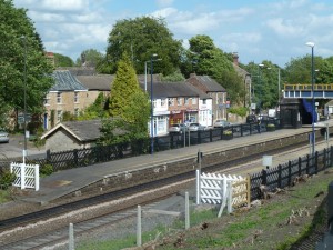
The path then skirted a large industrial area formerly occupied by Clay Cross Pipe Works.  The final stages of the clearance of the site for redevelopment were under way.  Rather lost between this site and the railway junction, the young River Rother still runs past wooded banks.  The next footbridge was almost spectacular, first crossing quite high over the river before continuing over the Alfreton line.   The churchyard runs all the way down the hillside to the path by the railway.  I used the road to get the views before exploring the outside of the imposing church of St Lawrence, North Wingfield.  The notice board was cheery with an encouragingly evangelical tone.  The picture is reserved for a street view to give an impression of the place.  (RW 5.7 – SK 4064 – Station Road, North Wingfield).

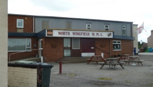
The route worked its way right, up New Street, which also had good views down from the top.  Here I almost missed getting a picture of the next square entirely, cutting across less of its territory than originally planned.  I only just avoided missing it altogether, and this is one I certainly did not do justice to.  Right at the edge of the square, North Wingfield Working Men’s Club came to the rescue as a subject for a picture.  This is an area where this type of club has something of a heartland.  (RW 5.8 – SK 4065 – North Wingfield Working Men’s Club).

It is on Chesterfield Road, which was followed a little way further north.  The field footpath was signposted but not in evidence amongst the crop on the ground, so I did an extra loop into a square visited on day 2, but it did include seeing a pleasant lake by the Five Pits Trail, where I stopped for lunch.  Back into the right square, I headed towards Williamthorpe Road.  (RW 5.9 – SK 4165 – Field footpath towards North Wingfield).

Crossing over, I was soon through more suburbs into fields again.  The A6175, rather like the A619, passes mainly through built up sections, which gives a bit of a false impression of the area – there are plenty of open spaces around the villages and small towns.  On the other hand, there is not the sense of being able to get deep into real countryside.   The fields and the little valley around Seanor farm are nevertheless quite rural.  (RW 5.10 – SK 4164 – Countryside near North Wingfield).

The next place to pass through was Parkhouse Green towards Lower Pilsley, then turning right towards Danesmoor.  (RW 5.11 – SK 4163 – Houses on Park House Road).

The constant swapping between road and footpath, field and housing was varied but in some ways also a bit tiring, not being used to this sort of walking.  The regular changes of direction and keeping tabs of the route finding in a new area also kept me on my toes.  Some of the lanes were not ideal for walkers, such as the one down to Danesmoor.  On the edge of Danesmoor there was an example of some of the new business and light industrial developments that are taking place in the area – a new bakery with its hunger awakening aroma.  (RW 5.12 – SK 4063 – New bakery, Danesmoor).

Beyond there was a much older industrial estate to pass through before recrossing the railway and the infant River Rother.  Think barbed wire, metal, machinery and you get the picture.  Once across to the other side of the valley, though, it was right back into farmland.  An early cropping was taking place, and swifts had obviously come from miles around to swoop low over the ground for the freshly exposed food source of insects.  They passed within feet of me, by the the largest numbers of these wonderful birds I have seen for a long time.   The fields were attractively patterned, with the next village out of sight beyond the brow of the hill.  (RW 5.13 – SK 4162 – Fields rising towards Pilsley).

These fields were crossed on a particular day when they were seen at their best, with the interest added by the swifts lifting this stretch to become the highlight of the day.  Another square, and another neat swap from field to village.  Pilsley dominates this square, and is of importance in the scheme of this walk because the source of the River Rother is just nearby in gently sloping fields above to the east.  I noticed Rother Street named in honour of this just off the main street through the village.  (RW 5.14 – SK 4262 – Village scene, Pilsley).

The village is quite substantial, with some modern estates added to the traditional houses, a couple of shops and chapels.  Heading by Pilsley Green, I turned west along Padley Wood Lane which descends towards a farm after turning left.   (RW 5.15 – SK 4161 – Padleywood Farm).

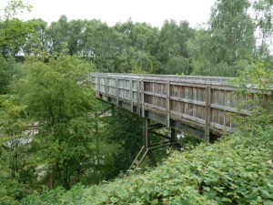
The farmland was not especially distinguished after the previous stretch,  but the walking was straightforward and pleasant.  Into the next square though, there was a sudden dip which turned out to be a substantial railway cutting with a remarkable wooden footbridge across.  I passed through a larger section of the square later, but this was definitely the subject for the picture.  (RW 5.16 – SK 4061 – Railway footbridge between Pilsley and Morton).

The unremarkable farmland resumed beyond, emphasising the highlight created by the railway.  The path turned into a track and then a little lane as it approached the next village, Morton.  (RW 5.17 – SK 4060 – Evershill Lane entering Morton).

Morton marked one of the less well defined watershed areas, where Rother headwaters give way to southward flowing streams.  The church was surrounded by dense trees with deep shade, and I left along Higham Lane then taking a footpath towards Northedge Farm.  It was around the farm that the route finding was the trickiest of the day.  I kicked up a storm of barking dogs on entering the farmyard, suggesting the path is probably not too frequently used.  The nearby caravan site had vans more closely packed together than I have ever seen before.  (RW 5.18 – SK 3960 – Farm scene near Northedge Farm).

The route was now bound directly north back to Danesmoor and Clay Cross.  Beyond Morton Road there was a long stretch with new woodland growing.  The sight of a few orchids added interest, otherwise there was little of note.  (RW 5.19 – SK 3961 – Footpath east of Stretton).

I sat for a break by the path and a man passed by with a dog following him.  The dog suddenly saw me and completely refused to come past.  In the end I got up and continued ahead, leaving both humans and the dog quite bemused.  Eventually I was heading past the edge of Danesmoor, with just the odd glimpse west from the tree lined track.  (RW 5.20 – SK 4062 – Track near Danesmoor).

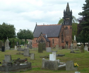
By this stage, on Friday afternoon towards the end of the first full week of the schedule, I was glad to still be on my feet and making forward progress.  Yes, I would admit to being a little weary, and quite glad to be nearing the end of the day, but was pleased not to feel I was over-extending my capabilities with the plans.  At least I wasn’t feeling like needing the services of the local graveyard just yet….  (RW 5.21 – SK 4062 – Cemetery and chapel, Danesmoor and Clay Cross).

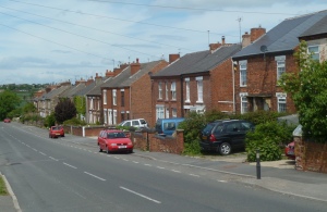
The final stretch into Clay Cross had several points of interest for pictures.  I have selected a scene looking along a street with the unusual name of Flaxpiece Road, at the junction with Commonpiece Road.  The circle was completed along the main road at the close of a fulfilled and fulfilling week.   (RW 5.22 – SK 3962 – Flaxpiece Road, Clay Cross).

2011 Rother walks – day 4 – Clowne, Barlborough, Renishaw

leave a comment »

Date of walk – 26 May.  Start – Clowne town centre.  Distance – 17.0 miles.

Clowne is a small town set off the busy Worksop to Chesterfield Road, close to the M1 motorway.  It has an industrial history, and as many places in the area, still shows signs of the struggles being faced since the closures of large industrial employers.  It has however a useful shopping centre.  I set off on the road north from town towards the A616 junction, the whole section being characterised by traditional terraced houses right by the roadside.  There is only a small gap between Clowne and Barlborough, which I entered along Clowne Road.  (RW 4.1 – SK 4876 – Entering Barlborough on Clowne Road).

South of the A619, the village is mostly of modern development, but on the other side there is the heart of a traditional village with older houses, a church, a couple of pubs, and a few shops.  It was pleasant to wander through although the skies were grey.  (RW 4.2 – SK 4777 – Village pub and cross, Barlborough).

I left the village heading north along Ward Lane, which is really just a track.  The skies began delivering the threatened rain, but it was only light and lasted little more than an hour.  Apart from the motorway, the most significant feature of the next square is Barlborough Hall School.  The public footpath passes close by, but with numerous stern warnings about the grounds around being private.  The park-like land formed easy and pleasant walking.  (RW 4.3 – SK 4778 – Looking back to Barlborough Hall School).

There followed the first of just two crossings of the motorway, using a farm track / footbridge.  It was an interesting feature of the walk to find out how many possible crossing points there are along the motorway, which did not create quite the barrier for route planning that I had feared.   With a couple of field footpaths not being too clear on the ground, I ended up doing a larger loop northwards than expected, and some time later ended up only a few hundred yards west of the bridge.  In place though, the views were quite extensive as the skies cleared.  (RW 4.4  – SK 4779 – Woodall Common).

In time the new woodland plantation will obscure the views, with Eckington being the town in view in the picture.   Again there were route finding problems with a farmer directing me back to a very indistinctly marked path into High Wood.  It sometimes seems that the farmers most concerned about walkers are also the ones with the poorest waymarking across their fields.  However, the woodland stretch was very pleasant.  (RW 4.5 – SK 4678 – Exiting High Wood).

The walking continued to be very attractive across a little valley and up to Parkhall Farm.  There followed a long farm driveway west to Spinkhill.  The little village is dominated by the Catholic College which is in the Jesuit tradition.  The steeple of the church, being on a hill, is a landmark for miles around. There are footpaths across the extensive grounds of the college, attractive and well kept.  Rugby is clearly the sport of preference.  (RW 4.6 – SK 4578 – College Road, Spinkhill).

I headed downhill to the Rother valley, following the line of the Chesterfield canal to Renishaw.  Heavy showers had been forecast, and the skies looked very threatening at times, but the still needed rain held off for a long time yet.  In a glint of sunshine with a dark background, the new housing development by some stranded waters of the old canal creating quite an atmospheric scene.  (RW 4.7 – SK 4478 – New houses and old canal, Renishaw).

Old canal and railway bridges run alongside one another under the A6135 Main Road.  The trail along the old railway track provided easy and fast walking, heading southwards, with just the odd glimpse of the river Rother.  There were other walkers and some cyclists around this section.  (RW 4.8 – SK 4477 – Former railway line, near Renishaw).

I nearly missed the turn for the Cuckoo Way which follows the line of the Chesterfield canal.  The Doe Lea, which is the largest tributary of the Rother, joins nearby.  The main feature of the square is associated with human settlement, valley floors, and water – yes, my routes encountered various sewage works in the area.  At leas there can be no doubt they provide a vital service – my thoughts turn again to the many areas of the world where poor sanitation and water quality leads to so many health and environmental problems.  I felt thankful to be in a country where we are so well provided for.  (RW 4.9 – SK 4476 – Sewage works, lower Doe Lea valley).

Continuing southwards, the quiet valley countryside gradually gave way to the houses of Mastin Moor and the traffic of the busy A619.  The approach was along the line of Norbriggs cutting, which was the longest branch off the Chesterfield canal.  It is now a quiet backwater – without the water.  (RW 4.10 – SK 4475 – Norbriggs cutting towards Mastin Moor).

Mastin Moor rises up the hillside eastwards away from the Doe Lea valley.  The road connects Chesterfield and Worksop and also has a motorway junction with the M1, and is therefore  a busy route, semi-urban a lot of the time, and often a slow drag for drivers.  I uses the village service road, set back a little from the traffic, before continuing along the main road above the village.  (RW 4.11 – SK 4575 – A619, Mastin Moor).

The road briefly passes through the next grid square, but there is no alternative route for through walkers, although the motorway cuts right through.  In many areas there is still a lack of footpaths and public rights of way across the English countryside.  So it is another road picture this time.  (RW 4.12 – SK 4675 – A619 between Mastin Moor and Barlborough).

It should be noted that I was passing this way at a quiet stage of the afternoon, plus my instinct when taking pictures is to catch a lull in the traffic.  With the slightly artificial imposition of covering map grid squares, the route cut back downhill almost parallel to the road, heading back towards the edge of Renishaw.  The route was along Woodhouse Lane, which is now just a track, becoming a little used path lower down.  (RW 4.13 – SK 4676 – Woodhouse Lane).

Beyond the tree lined section the views soon opened out across attractive countryside.  Threatening looking clouds were moving in, so the picture is from the edge of the square before the sun went in.  However, the rain still held off.  (RW 4.14 – SK 4576 – Countryside view towards Spinkhill, zoom shot).

The lane was then followed past Beightonfields, and a footpath left keeping just away from the edge of Renishaw village at Emmett Carr.  That this is an area of rapidly changing views was confirmed when emerging onto the main road on the hill out of Renishaw.  (RW 4.15 – SK 4577 – Industrial site near Renishaw).

The country views north towards Spinkhill were soon re-established.  It seemed a long climb up towards Barlborough, and by now the traffic was starting to get quite heavy.   The hamlet of Barlborough Low Common caught my attention, set off the road on a little dead-end lane, hardly noticed when driving past.  Still onwards, and upwards.  Towards the top, the road widens into an uncharacteristic stretch of dual carriageway near the motorway junction.  The verges show that roads are not necessarily a disaster when it comes to flowers and wildlife.  At this stage of the spring ox-eye daisies were the dominant flower.  (RW 4.16 – SK 4677 – A6135 below Barlborough).

Soon the motorway was crossed and I was in a part of Barlborough not seen earlier in the day.  The conditions were a bit muggy and showers now seemed imminent, but so far just a few spots.  The residential stretch of the village did little to engage the attention and when I got home I realised I did not get much of a photographic record, with the A619 being beset by modern hotel and fast food developments.    (RW 4.17 – SK 4776 – Path between houses, Barlborough).

The mood didn’t really lift.  Having walked this route before, Slayley Lane was sadly confirmed as one of my least favourite stretches of the whole series of walks, despite the appearance of the map suggesting otherwise.  The track itself is hard when dry and very muddy when wet, and is hemmed in by high hedges and trees with little chance to see the valley being crossed.  Whichever direction, it seems to be a gloomy descent followed by a dismal climb.  And just as the clouds seemed to be lifting, the rain came on harder, eventually to develop into quite a hefty shower.

An old railway bridge is crossed, with the line lost in a cutting full of undergrowth.  Things improve towards Clowne, with a bit more variety of scene in view.   I took a path cutting up to Boughton Lane, crossing fields and finally a small paddock to reach the built up area.  (RW 4.19 – SK 4875 – Houses and horses, Clowne).

The town itself was seen at the height of the rain.  The bus times had changed from the sparse information I had found, so the  close of this walk was not the brightest spot of the project, due more to a combination of circumstances rather than the place itself, which although not picture postcard material, really doesn’t deserve the impression I am giving.  In fact the streets looked quite atmospheric in the conditions.  Another day completed – if this is what counts for a low point, then I should feel happy and confident about the progress of the project, because in overall terms the dip in mood was really very insignificant.

2011 Rother walks – day 3 – Dronfield, Common Side, Bradway

leave a comment »

Date of walk – Tue 24 May.  Start/finish – near Dronfield station.  Distance 17.5 miles.

Dronfield is the second largest town in the area covered, and like so many places was new to me.  It certainly looks worth exploring with interesting surrounding countryside and good access to the Derbyshire Peak District, despite being so close to Sheffield.  I must immediately mention the commitment to the local footpaths with many well signed routes around the nearby hillsides, which is very commendable.

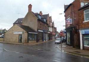
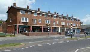
The actual start and finish was the B6057 / B6158 roundabout just east of the station.   It was a bright sunny morning, and there are many photo opportunities around the town, so there will be two pictures from the square to mark the start and finish of the walk.  (RW 3.1 – SK3578 – Town scene, Chesterfield Road, Dronfield ).

With hillsides crowding around the town on most sides, climbing was soon involved, heading south towards the golf course.  (My typing often turns golf into gold, which is probably the closest I’ll get to obtaining any riches through sport).  The climbing means views quickly open out, as shown in the picture from Hallowes Lane.  (RW 3.2 – SK 3577 – Hallowes Lane, Dronfield).

Golf courses take up a lot of ground, as the project emphasised over the days.  I am of the “good walk spoiled” school of thought personally, although top class professional golf is great to watch on TV.  The light was good through the trees at the edge of the course, but the self imposed limit to the format of the reports means that the one picture from the square will be from further along.  A footpath edges around the course with limited views, and then enters extensive woodland either side of the main A61.  Woodland can be a challenging environment for photography, so my results are often disappointing, however great the actual enjoyment of woodland sections of the routes in reality.  The view is of the impressive footbridge over the dual carriageway.  (RW 3.3 – SK 3576 – A61 footbridge, Monk Wood).

Resuming woodland surroundings beyond, the track eventually emerges into open valley farmland towards Barlow Brook.  The ground was bone dry again after the small amount of rain the previous day.  (RW 3.4 – SK 3575 – Track from Monkwood Farm).

A pleasant valley walk followed on close to the south side of the brook.  There was a popular fishing lake on the other side, and some interesting looking properties around, but generally just a quiet rural feel.  (RW 3.5 – SK 3475 – Fields by Barlow Brook).

The path joined a minor lane rising up towards the chapel between Barlow and Common Side.   There is a lovely view along the lane down into the rural village of Common Side.  This is really the sort of sight that beckons you onwards as a walker, and (looking back) was probably my favourite village scene the whole trip.  (RW 3.6 – SK 3375 – Common Side).

It was a pleasure to follow the lane winding through the village.  Beyond I took the little lane right to Brindwoodgate, and stopped for refreshments making use of a bench by the lane with views back to Common Side.  The heaviest items in my bag were the three bottles of drink (two plain water) which I could enjoy and still take for granted even in the current dry spell.  My thoughts from time to time went to the Turn on the Tap appeal, remembering that there are so many people around the world who cannot take supplies of clean water for granted.  Sometimes I tried to think what impact that must have on daily life, but it was difficult to appreciate all the implications on time, energy and patterns of life.  Soon it was onwards, and in this case, upwards, towards Barlow Lees.  The hamlet is hardly at a high altitude, but the south facing slopes give wide views, and were growing a variety of crops, including potatoes.  (RW 3.7 – SK 3376 – Fields below Barlow Lees).

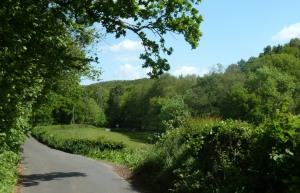
The lane winds around the hillsides with a truly rural feel despite being close to Dronfield.  There was very little through traffic in evidence.   The next square was an attractive mix of fields and woodland, very difficult to rush through bearing in mind the need to keep up some forward motion to achieve 17 or so miles in the day.   The secluded corner shown in the picture was an especially appealing stretch of the lane, near Lees Common.  (RW 3.8 – SK 3476 – Barlow Lees Lane).

After crossing the little stream, the lane lane rises through woodland then fields with an increasingly upland feel.  It comes as a surprise to realise that you are approaching the A61 (no junction for vehicles) and the edge of Dronfield.  The lane curves through every quarter of the square, so may represent the longest distance I covered within any single square.  After turning away from the main road the country views were once again predominant.  (RW 3.9 – SK 3477 – Countryside near Dronfield).

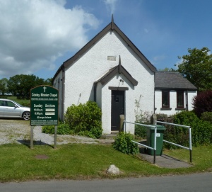
The next destination on the route was the small but straggling village of Cowley.  The highlight was the sweet little whitewashed Mission Chapel, which without further ado is shared as the next photo subject.  (RW 3.10 – SK 3377 – Cowley Mission Chapel).

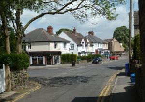
It is clearly in use and well cared for and loved, with morning and evening Sunday services, which was good to see.   I finally parted company with the lane, taking a lovely path through fields and the small woodland areas of Spring Wood and Kitchen Wood, finally arriving at the edge of Dronfield Woodhouse.   I would be very tempted to break self imposed rules and add one or two more pictures from this square, but must pass on.  More pictures can be seen on Geograph, and hopefully later on Flickr too.  The residential area of Dronfield Woodhouse was one of the most attractive of the modern estates visited during these walks.  (RW 3.12 – SK 3378 – Residential street off Leabrook Road, Dronfield Woodhouse).

Older houses were encountered on reaching Carr Lane, which was followed left, uphill.  Continuing west across fields, the watershed was eventually reached with Totley coming into view – the western edge of the territory covered by the walks was encountered for the first time.  It was interesting to see how the project was really helping to get to grips with the geography of the area and to appreciate the lie of the land.  Of course it was not really a major watershed, with the Rother flowing into the Don which collects the tributaries from the famed hills and valleys around Sheffield, including the Sheaf itself whose valley now lay below.  (RW 3.13 – SK 3278 – View over the watershed).

As far as today’s route was concerned, it meant almost doubling back, heading to the hamlet of Mickley, but it was good to have a sneak “over the edge”.   Mickley is near the headwaters of one of the streams that combine to form the Drone in Dronfield.  These minor upland valleys form an important green belt beyond the city limits of Sheffield.  (RW 3.14 – SK 3279 – Green belt between Sheffield and Dronfield).

Heading north, at the next grid line I crossed into South Yorkshire and within the city limits of Sheffield.  You see, Sheffield sneaks over the edge of the watershed in a narrow strip along the suburbs from Bradway to Jordanthorpe, so duty called to tackle these city fringes.  The corner of SK 3280 hardly counted, but the B road – Bradway Road and Greenhill Parkway – stays quite close to the line of the watershed.  Edmund Avenue and Reney Avenue are residential streets set back a bit, so I added them to the route for a change from the main road.  (RW 3.15 – SK 3380 – Reney Avenue).

I ventured over the brow into Greenhill, but failed to get decent pictures of either of the churches featured in the square, both almost on the watershed.  Instead a residential street and a fish and chip shop will have to suffice.  (RW 3.16 – SK 3481 – School Lane, Greenhill).

Next it was the turn of the suburb of Lowedges, an uninspiring mix of flats and houses.  (RW 3.17 – SK 3480 – Parade of shops, Lowedges).

Jordanthorpe and Batemoor, to the east, have a mix of more modern flats and houses, but are hardly any more inspiring, and dominated by a tower block.  The green space around the houses and flats seemed a bit more imaginatively arranged.  It was interesting to take a bit of time to walk along the edge of one of our larger cities.  The suburbs seem impersonal in so many ways, and yet are home to so many individual lives with their varied achievements and needs.  I am by no means a true country person, and lived for a number of years well within the Leeds city boundaries, but the allure of the city that is so strong for many around the world does not work for me.  There simply seem to be too many people to retain a sense that every person is an individual – how many front doors did I pass without a thought of each being the symbol of home for an individual or family?  (RW 3.18 – SK 3580 – Batemoor Road).

At the edge of the city limits I crossed back into Derbyshire.   Dyche Lane crosses the green belt at its narrowest point, to Coal Aston at the northern edge of Dronfield.  A waymarked path called the Sheffield Country Walk rings the city, and I followed part of it westwards across the green belt.  (RW 3.19 – SK 3579 – Sheffield Country Walk near Dronfield).

The route crosses the old main road and then under two bridges, one for each carriageway of the current A61.  After some farmland the second golf course of the day was reached.  (RW 3.20 – SK 3479 – Track under the A61).

The golf course setting is really quite attractive and I’m sure helps to shield the green belt area from further development.  It is called the Dore and Totley Golf Club, although those places are out of sight over the hill.  (RW 3.21 – SK 3379 – Dore and Totley Golf Club).

The final section of the route headed back in to the centre of Dronfield, once again involving crossing the A61.  The houses in the picture are just above the bridge.  (RW 3.22 – SK 3478 – Houses near the A61, Dronfield).

The centre of Dronfield must take quite a few visits to get to know properly, as there is a network of narrow, twisting streets.  This first visit did not provide a proper opportunity for exploration beyond the planned route, but it was a pleasant walk down the High Street and Church Street.  Although taking care to cover every km grid square seems quite detailed, I was very aware of barely scratching the surface of the places visited.  The final picture from a varied walk on a lovely day was taken by the station, back in map square from the start of the walk.

Walk schedule – day 10 to day 17

leave a comment »

The planned series has been completed.

Day 10 – 6 Jun – Heath, Sutton Scarsdale, Shuttlewood.  17.5 miles.

Day 11 – 7 Jun – Holymoorside, Wadshelf.  15.8 miles.

Day 12 – 9 Jun – Tibshelf, Hardwick Hall.  17.2 miles.

Day 13 – 10 Jun – Whittington, Barrow Hill, Marsh Lane.  16.3 miles.

Day 14 – 14 Jun – Dronfield (east), The Moss valley, Unstone.  17.9 miles.

Day 15 – 16 Jun – Stone Edge.  17.5 miles.

Day 16 – 17 Jun – Killamarsh, Rother Valley country park, Wales.  14.7 miles.

Day 17 – 20 Jun – Chesterfield, Brimington, Calow.  17.3 miles.

TOTAL 288.7 miles (average 16.98).

Written by andrewh00

June 23, 2011 at 8:31 am

Posted in Uncategorized

Walk schedule – week 2

leave a comment »

Walk 6 – Mon 30 May.  Eckington, north of Staveley etc.  Walk completed – 16.7 miles.

Walk 7 – Tue 31 May.  Holmesfield, Owler Bar.  Walk completed – 17.2 miles.

Walk 8 – Thu 2 June.  Staveley, Duckmanton, Stanfree.  Walk completed – 17.1 miles.

Walk 9 – Fri 3 June.  Chesterfield (west), Old Brampton.  Walk completed – 17.8 miles.

Written by andrewh00

June 5, 2011 at 7:21 pm

Posted in Uncategorized