Archive for the ‘RCA – River Rother’ Category
Walk A001 – River, canal and woods near Chesterfield
Walk summary details.
RCA – Rother. Start – Spital Lane, Chesterfield, SK 390707.
Distance – 9.0 miles. Squares visited – 12 + 3 + 1. Date – Sat 5 March 2011.
Weather – low cloud, drizzle at times, no sun, cool, little wind.
Keep as close as possible to the River Rother or Chesterfield Canal to Barrow Hill. Road through Hollingwood. Path Ringwood Park and West Wood by Trough Brook. Roads through Brimington Common to path across Chesterfield golf course, return to start.
Walk report and pictures.
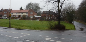
I headed north across Hady Hill, the main A632 road heading east out of Chesterfield towards Bolsover. The River Rother is rather secretive, but a path switches from bank to bank amid new housing (Pic A001/1 – SK 38987118 – S).
 Crossed river back to east side at Wain Avenue, followed by Picaddilly Road, left, and left again at Crow Lane towards the railway line near the station.
Passing a small recreation area, a distinctive feature catches the attention – a huge silvery mollusc in the grass, which has to be worth a picture (A001/2 – SK 38907138 – ESE).
 After this surprising sight, the complex of low railway bridges seems rather ordinary. They serve as a reminder that transport routes traditionally followed natural routes. Too much road travel can lead to a lack of appreciation of the landscape. According to the lie of the land, Chesterfield is connected with Rotherham by the river. (A001/3 – SK 38787148 – E).
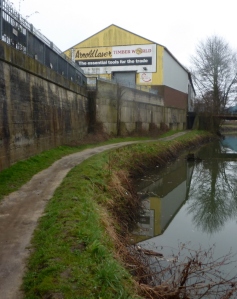
 Crossed the river at the viewpoint shown, recrossed at the Brimington Road bridge, through a rather drab old industrial area, the path being on the west bank of the river. A footbridge crosses the river once more. Brimington Road is close by, but behind buildings or high walls. (A001/4 – SK 38857213 – S).
 Soon the point is reached where the Chesterfield canal branches from the river, although it follows the valley floor for a considerable distance. It is easier to follow the canal, at least for some distance, as the valley curves northeast then east.
Here we are in northeast Derbyshire, not far from the Yorkshire border. I sometimes ask myself the question, where is the north-south dividing line? No doubt there are many possible answers. If a straight line is wanted, Lincoln – Chesterfield – Buxton – Chester may work quite well. Most would put Sheffield in the north but Mansfield not, so this may be somewhere near the mark.
The next picture is of the first bridge on the Chesterfield canal, which is just by the first lock (gates can just be seen through the bridge). (A001/5 – SK 38857247 – S).
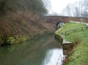 Given the industrial past, the feel of the walk along the canal is surprisingly rural, even at the start so close to Chesterfield itself. Along this stretch I found some of the first signs of spring as far as fresh new foliage is concerned. (A001/6 and A001/7).
***
***
***
***
 There is a long bridge under the busy A619 road, the Rother Way. This road serves the long line of urban development through Brimington to Staveley and beyond. It is a link to the M1, and the main route to Worksop. It must be admitted to being a drag when driving, and gives quite a different impression to the area from the walk along the canal. Don’t judge an area just by a familiar road route. Railways often pass through old industrial sectors, giving the worst aspect of places as well.
In fact, the canal emerges from the bridge immediately reveal a lock and an attractive visitor centre. The whole stretch of canal was restored in recent years, so it is not long ago that it was all very run down and neglected. These days it all looks quite good. (A001/8 – SK 38727293 – NNE).
 Beyond here the route starts curving northeast then east, soon passing under the railway just after a split. The first bridge is the line to Dronfield and Sheffield, the further one is the Rother valley line. (A001/9 – SK 38767312 – NE).
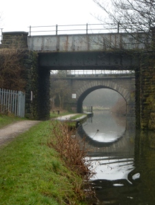 It seems worth including a picture detailing the stonework of these bridges – the style of the work, the effects of years of industry. There is also interesting plant growth in the stonework in places. (A001/10).
 On such a dull day, the next stretch did seem a bit featureless. After some distance in the open, light industrial buildings are passed on the left and the bridge for the B6050 road between Brimington and Whittington is crossed. There is a pub, The Mill, handily located for those interested in such establishments. Just beyond there was a boat moored with local information displayed. (A001/11 – SK 39297382 – SE).
 The next feature is Wheeldon Mill lock. Various named routes for walkers are available crossing at the bridge. Continuing along the canal, bends lead into a secluded section with a tranquil rural feel. A pool and a stream mark the former course of the main river which has been straightened out in a channel to the north. (A001/12 – SK 39627452 – WSW).
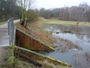 The next lock has the intriguing name of Bluebank lock. An embankment beyond gives a more elevated view of the area. (A001/13 – SK 39917475 – SW).
***
***
***
***
An unexpected splash of colour was provided from a young gorse bush in early bloom. (A001/14).
A distinctive new or replacement bridge at Bilby Lane looks a little odd when the traditional style of canal bridge is so familiar. They do show many subtle variations, but this is definitely different somehow. This is the last stretch of this walk to use the canal towpath. (A001/15 – SK 40157474 – SE).
 Looking back from the bridge we have one last canal picture for this walk. (A001/16 – SK 40237467 – WNW).
Turn north along the track (Bilby Lane is not a road), towards the river. I crossed over and followed the north bank to the east. The whole area is clearly in transition. Even on a first visit to a new area it is clear that it was once dominated by industry, but slowly most of it is returning to a more natural appearance in what would be an attractive valley scenically. The cluster of snowdrops on the riverbank is a sign of the changes in progress. (A001/17 – SK 40317501 – E).
 It was perhaps appropriate to walk on a dull, fairly bleak sort of day – it was really quite atmospheric. There is a fair stretch on the riverbank between New Whittington and Barrow Hill. (A001/18 – SK 40957511 – ENE).
***
***
 Before reaching Works Road, which gives a bit of a clue about the nature of the area, the path goes through a small but dense plantation of birches. (A001/19 – SK 41417520 – ENE).
***
 The exit onto Works Road needs care – there is a drop right onto the road and poor visibility. Turn right to cross the river, beyond which are two large buildings formerly associated with Staveley Steel Works. The more impressive one has a clock tower which gives it its name. Both have seen attempts to develop as business centres. My impression passing by on a dull Saturday afternoon was that they do not appear to be tremendously successful. (A001/20 – SK 41667489 – N).
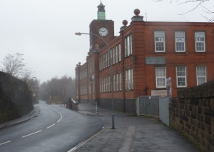 The road then crosses the canal giving the final view of it for the day. Beyond it is named Troughbrook Road after the stream alongside, with traditional residential development on the other. The route crosses the A619 in a dip at a busy crossroads. (A001/21 – SK 41757389 – NNW).
***
Traffic is quickly left behind on entering Ringwood Park. The stream, woodland and open spaces are attractive, but the highlight is probably the little lake, especially the track on the steep sided east shore. (A001/22 – SK 41757355 – N).
 At the far end of the lake there is a farm. Despite being so close to built up areas and right by a park, the buildings and surroundings have a real rural feel. There is a glimpse of the farm buildings through the trees. (A001/23 – SK 41747340 – WSW).
 Trough Brook is well named – it has a well formed, steep sided little valley. It was a surprise, not really expected from the map, and a real addition of interest and variety to the walk. However, the path was muddy, and an especially slippery type of mud at that in the woodland on quite steep ground in places – not an easy walk. West Wood is worth the effort, with something of an air of wildness about it. (A001/24 – SK 41787307 – SW).
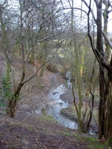 Don’t get me wrong. A TV programme about Canada recently stated that early travellers defined wilderness as being able to travel for 2 weeks on horseback without seeing any sign of man. So Britain is hardly big enough to begin with, and round here we are ten minutes walk at most from lots of houses in every direction. But this is a little spot tucked away and does a good impression of being more remote than it is. Further along there is an imposing stand of beech trees. Being such a gloomy day the pictures didn’t come out too well. Eventually the path becomes wider and easier, but still very much with a woodland theme. (A001/25 – SK 41447204 – SW).
 The path emerges into open fields and climbs to the village of Brimington Common. In a short distance the return to a thoroughly urban feel seems complete, but this is largely ribbon development along Manor Road. (A001/26 – SK 40867179 – N).
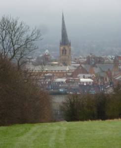
 Brimington Common merges with Calow, which indirectly practically merges with Chesterfield. The direct route, however, is a little country lane even though the large complex of the hospital can be seen to the south. A path leads through the gold course with views over Chesterfield, including the famous crooked spire. It comes out on Piccadilly Road, a short way from the start. (A001/27 – SK 39457133 – WSW).


